
Tonight, Council may Lay Groundwork for Future Uses of Downtown Redding Riverfront Land
The direction the council establishes tonight, May 20, will inform how an update to the Riverfront Specific Plan is drafted. That document, once approved, will establish how prime public and private land can be developed, likely for decades. Here’s what you need to know.
For almost four years now, the Redding community has hotly debated the future of prime riverfront land downtown. Strong public discourse began in the fall of 2021, after it was revealed that a real estate negotiation that had been scheduled to occur during the city council’s closed session involved a proposal to develop public riverfront land.
Outrage, first over the lack of transparency in how the land was identified on the council’s agenda and then over the proposal itself, spurred months of public pushback, and subsequent city-led workshops. Nearly a year later, after hours of public comment and council debate, council member Erin Resner successfully motioned to pend larger discussions on riverfront development while funding a $1.25 million dollar update to a decades-old document known as the Riverfront Specific Plan.
The Riverfront Specific Plan is a legally-binding land planning document that includes design guidelines for buildings, circulation guidelines for transit, and analysis of infrastructure capacity. The document also provides economic analysis which can include financial incentives for future development.
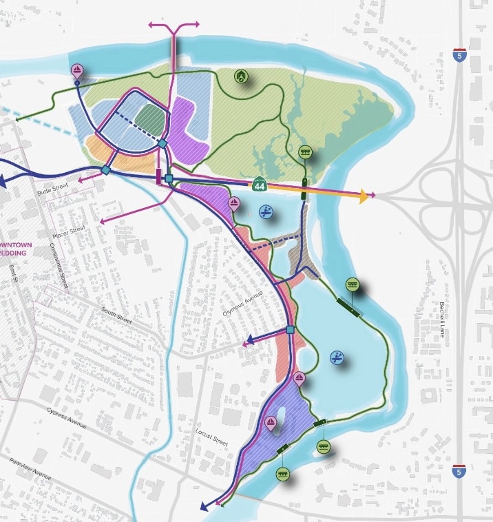
The process to update the Riverfront Specific Plan will continue tonight, May 20, as the council discusses city staff’s “emerging concepts” for how 380 acres of publicly and privately-owned Redding riverfront land downtown could be developed in the years to come.
The concepts provide a visionary look at how the interests of various stakeholders in Redding’s community, which are sometimes at odds with one another, could be represented at the riverfront in future. Staff’s proposed map of how riverfront land could be allowed to develop includes space dedicated to land conservation, as well as proposals to allow new development including an 8,000 seat indoor/outdoor venue and mixed-use buildings next to publicly-owned riverfront land.
If the council approves staff’s proposals tonight, this vision will guide how the Riverfront Specific Plan update is drafted, a process that will likely take another year. That document, once completed and approved, will be legally binding — providing the core boundaries around how prime riverfront land can be developed in future.
Here’s What’s Being Proposed for the Northern Riverfront
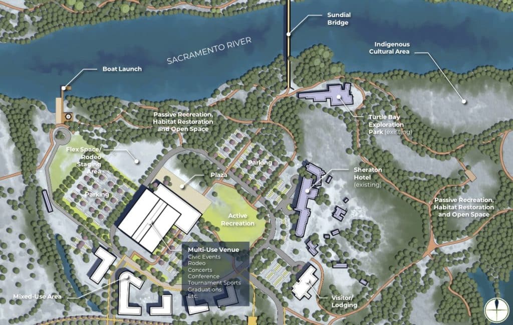
At the northern riverfront, which includes publicly-owned land that currently houses the Redding Rodeo and Civic Auditorium, staff are suggesting the Riverfront Specific Plan be updated in a way that allows for a new event venue to be built: an indoor/outdoor facility with a retractable roof that would replace both the current Civic and Rodeo facilities and accommodate up to 8,000 people. For a sense of scale, the Civic currently seats 2,000.
Additionally, staff have suggested prioritizing habitat restoration and recreational opportunities such as river trails and viewing stations. They’re also proposing the creation of dedicated space for local tribes, who are the original land owners.
There is also a suggestion to form a “Riverfront Consortium,” which would be involved in management decisions related to the public land at the northern riverfront and include representatives from key stakeholders including Tribes, the Redding Rodeo Association, and Turtle Bay Exploration Park among others. Scant details are known so far about how such a group would be formed and administered, including whether its actions would be publicly accessible.
A redesign of Highway 44 is also being floated in the proposed framework for what the Riverfront Specific Plan could allow in future. The redesign could include a second pathway in and out of the northern riverfront for improved safety and new mixed-use buildings, including housing that could be developed next to public land.
Here’s What’s Being Proposed at the Southern Riverfront
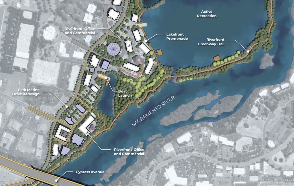
The area being referred to as Redding’s southern riverfront is largely privately-owned. Updates to the Riverfront Specific Plan in this area, staff propose, would be designed to encourage “water-oriented development,” or architectural plans that complement the visual and physical path of the river, and allow for ongoing commercial use of the riverfront.
Staff’s vision for this land area includes design guidelines that would apply to new or substantially remodeled buildings, a walking and biking trail and a redesign of Park Marina Drive that would attempt to balance the interests of commercial and residential occupants of the area while increasing safety.
What Else You Should Know
It’s important to remember that the development ideas being presented by city staff tonight are not reflective of any actual proposed projects so far. They’re just a vision for what could be allowed to develop at the riverfront under the legal guidelines of a newly updated Riverfront Specific Plan.
Should the council agree to the emerging concepts being proposed, staff would work to update the Riverfront Specific Plan plan in a way that would allow for these kinds of development in future. But whether or not the specific projects envisioned so far ever actually come to fruition will also depend on whether each specific project is actually proposed and funded in future.
Do you have a correction to share? Email us: editor@shastascout.org.
Author

Comments (2)
Comments are closed.
Related Articles
Planning commission to discuss Redding Riverfront Plan this week
As the city kicks off an environmental process related to downtown riverfront planning, the public is invited to share comments on the scope of the project through March 2.
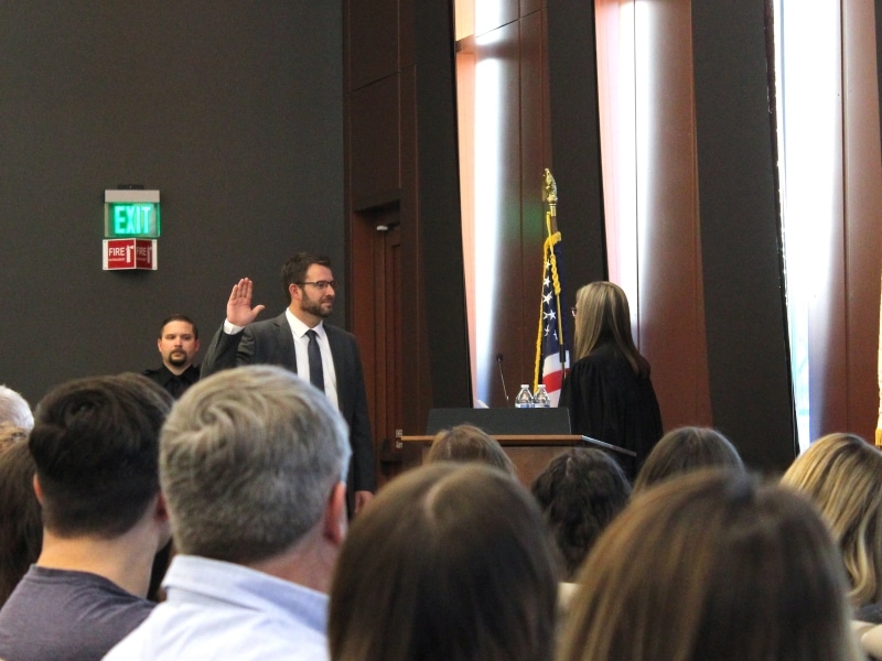
Redding attorney sworn in as new Shasta Superior Court judge
Patrick Deedon was a Redding-based attorney for about two decades before being appointed to the superior court by Gov. Gavin Newsom.
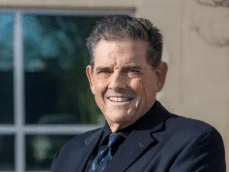
Shasta’s Public Works director announces retirement
Troy Bartolomei has served more than two years in his current role and 35 years as a county employee.
I thought the City just signed a really long term leased for the rodeo property out to the Rodeo Association organization. This new plan would tear down the rodeo space we have now. Sounds like the left hand doesn’t know what the right hand is doing at the City.
Nathaniel: It’s definitely confusing. City Manager Barry Tippin has said the lease contract includes wording that would allow the city to renege on its contract if they pay the rodeo back for any improvements already made since the lease was initiated.